
Volumes without stopping plant
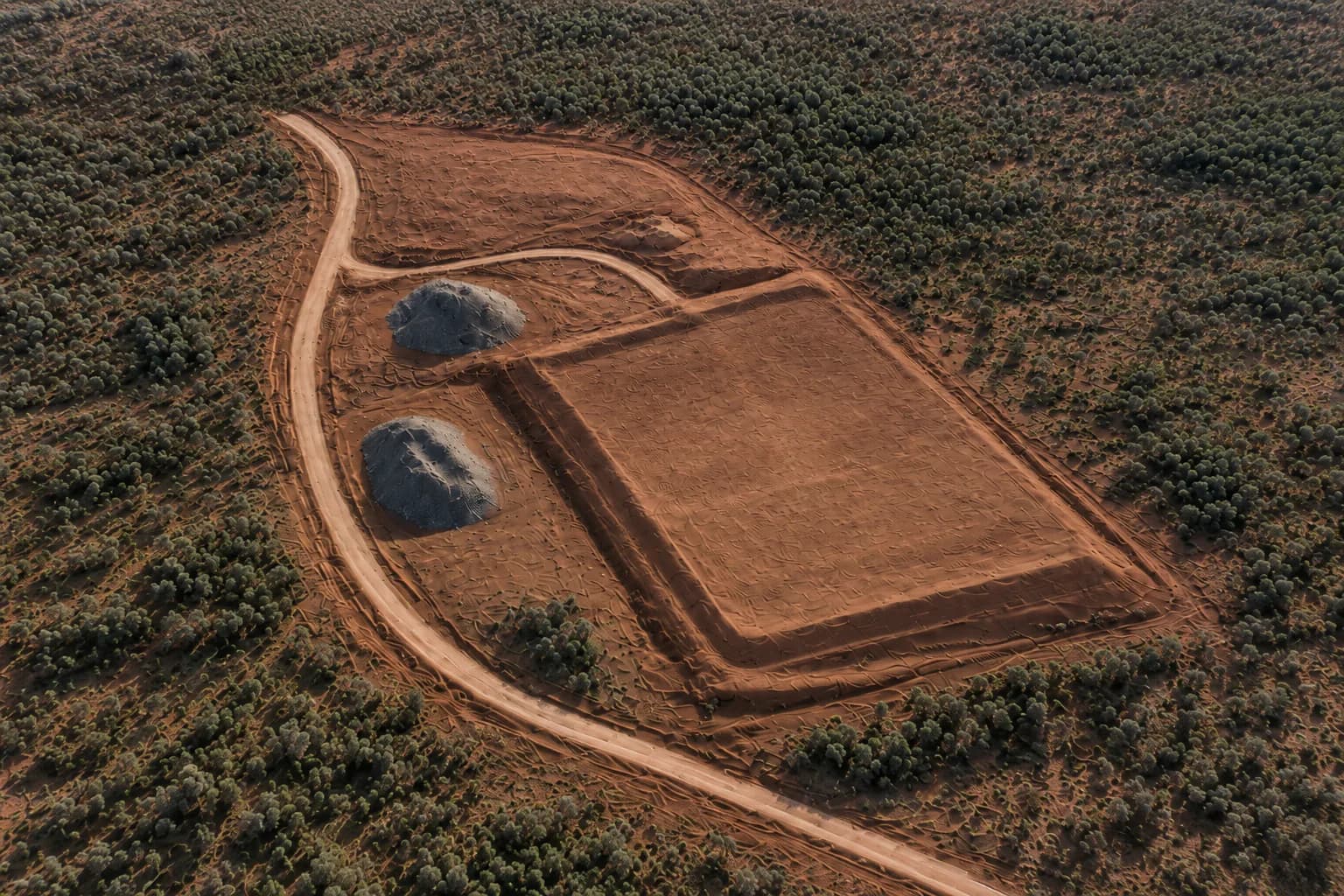
Stockpile and excavation quantities come from the surface model, so the site does not need a ground walk of every pile.

Loading spatial data
Civil & Earthworks
This service talks in the language of site teams and contractors: work completed, material movement, and changing ground conditions.
Written by ONPOINT DATA SOLUTIONS, Darwin & Palmerston, Northern Territory. .
Regular aerial capture gives superintendents and contractors a shared picture of stockpiles, excavations, and pad geometry — without interrupting plant. The conversation on site is about cubic metres moved, pad shape, and what changed since last month, not about the drone.
Cut/fill and surface comparison are provided where suitable source or reference data is supplied and the agreed workflow supports it. If you have a design surface, a previous capture, or agreed control, that becomes the reference. If you do not, we still deliver a current surface and volumes from the capture itself.
This service is written for civil contractors, earthmoving crews, and construction teams in Darwin, Palmerston, and regional NT. It is not machine-control, construction set-out, or a statutory mine-survey function. Stockpile and quarry snapshots support operational planning. They do not replace a licensed mine surveyor where the law requires one.
Repeat visits are the useful part. A first capture sets the baseline. Later flights, flown with a consistent method, show haul-road change, batter movement, and material drawn down or built up. That record sits beside the program and the claim conversation.
Benefits
Stockpile and excavation quantities come from the surface model, so the site does not need a ground walk of every pile.
Surface comparison is offered where a usable reference is supplied and the scoped workflow supports it.
The same method on later visits means the difference you see is the earthworks, not a change in how the site was flown.
Workflow
Define the site, project objective, required outputs, coordinate/datum requirements, and any supplied control or reference information.
Plan and fly systematic overlapping high-resolution imagery using an appropriate RTK-enabled workflow and site controls where required.
Process imagery into the agreed spatial products; review the dataset and validate against the control/check methodology appropriate to the project.
Supply the agreed maps, models, imagery, quantities, reports, or compatible data files with relevant project notes and limitations.
Applications
Civil construction, land development, and suburban earthworks programs.
Haul roads, remote pads, and sites where mobilisation is part of the job.
Stockpile and site-progress records — not statutory mine-surveyor functions.
FAQ
Not in this service. We provide project mapping and quantities, not construction set-out or machine-control files.
Cut/fill is offered where suitable reference data is supplied and the workflow supports it. That is confirmed during scoping.
No. We provide operational site snapshots and quantities. Statutory mine survey sits with the licensed surveyor required for that work.
Mapping, earthworks, inspections, and progress capture are scoped as separate jobs or as one program. See the rest of the set, or send the site details.
Request a quote
Share the location, the outputs you need, and the timeframe. We will come back with a practical capture plan.
ONPOINT DATA SOLUTIONS
Darwin & Palmerston, Northern Territory
Australia
enquiries@onpointdatasolutions.com.au
Civil · Earthworks · Inspections · Progress records